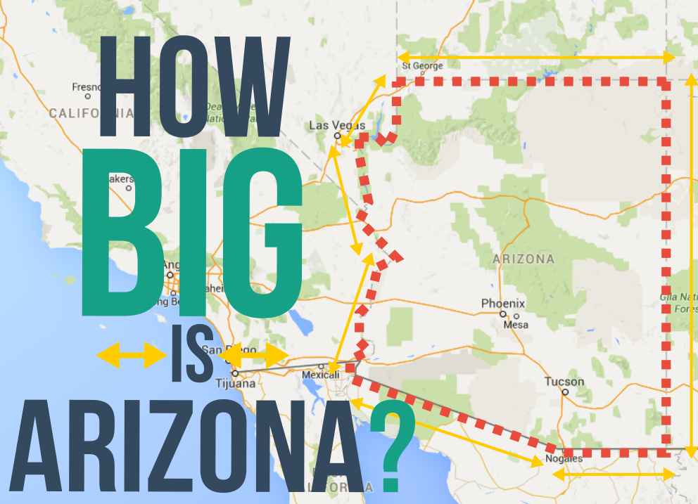
Weighing in at 113,998 square miles of land area, Arizona is the 6th-largest state by land area, coming in right behind New Mexico and just in front of Nevada. But how big is it really? Many people have a hard time visualizing 113 square miles, let alone 113,998. You might be tempted to look at a map to get a visual sense of Arizona’s size, but be careful: most 2D maps massively distort area in favor of shape and presentation. This includes trusty Google Maps, which uses the popular Mercator Projection, a map projection which sacrifices the accurate display of size in favor of shape and presentation. With the Mercator Projection, geographic bodies become larger as you move further from the equator and towards the poles.
In order to compensate for these distorted 2D maps, we used special mapping software to create an outline of Arizona. As we move the outline around the map, it changes its shape to account for the projection’s distorting effects. This allowed us to create the following maps which accurately compare Arizona’s size to bodies of land around the world. For Arizonans more familiar with Arizona’s size, these maps should help put the size of other places in perspective and show how much these map distortions affect our perception. For those less familiar with Arizona, these maps will help give you an idea of how massive this gargantuan state really is.
Also, because this is the kind of thing we think about at SelfStorage.com, you’d need 15,890,409,216 10×20 storage units to store Arizona.

Embed this image on your site (copy the code below):